Inigo Insurance evaluates risk potential with Galigeo and Power BI
Inigo, global specialist of high-risk insurance and reinsurance, is serving some of the world’s largest commercial and industrial enterprises by putting datascienc of the core of their business.They use Galigeo embedded into Power BI to create meaningful location-driven reports, that help stakeholders make the most informed decisions.
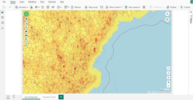
Focusing, preventing and estimating impact of events
Using Galigeo Location Intelligence, Inigo is able to overlay NOAA’s predicted hurricane trajectory and intensity with their customer locations. The resulting map dynamically displays customers risk levels by areas.
Clients can receive precautionary instructions, for example, to move assets (i.e., trucks, machinery, etc.) to higher grounds. This real-time information is key to improving safety, minimizing cost, while allowing business to continue safely in unaffected areas, because false-positives are also a source of cost and unnecessary stress. Insured clients will appreciate.
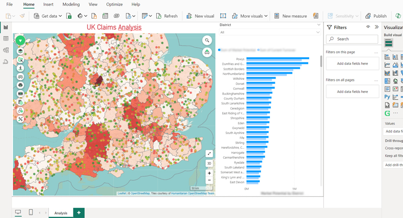
Ranking claims and detecting fraud
Using Location Intelligence, Inigo’s data analysts are able to prioritize claims on the basis of data analysis.
By looking at event paths (like hurricane or flood) with different indicators (weather, severity, water levels, wind strength, …) alongside customer data, such as type of home, customer policy coverage, and more, insurers are able to rank claim orders. These are sound data-driven decisions.
They also detect non hurricane-related claims, and trigger further investigations to limit false claims or opportunistic behaviors.
With faster, more precise and fairer compensations, it results in an improved quality of service for policyholders before, during and after the event.

Facilitating collaboration and enhancing creativity accross teams
With Galigeo being embedded within Microsoft Power BI, it’s a breeze for analysts to share their location-driven reports with business stakeholders across different teams within the company, while always complying with internal security rules.
Inigo in figures
Discover more about Inigo Insurance
$1bn
gross written premium (and growing)
200+
employees leveraging Galigeo and Power BI
UK
based in London, UK